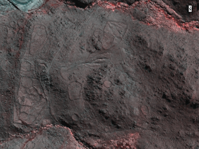
Archival high resolution 8-band multispectral satellite coverages (WorldView 2) are analysed using a range of image processing tools such as near infra-red false colouring, NDVI, unsupervised classifications, Tasseled Cap transformation etc). These highlight in more detail the nature and extent of vegetation coverage and the contrast to bare soil areas.
Satellite-generated high resolution Digital Surface Model (DSM) and medium resolution Digital Terrain Model (DTM) forms the basis for topography-dependent hydrology and spatial analysis. These will allow us to assess the distribution of human presence in relation to relative humidity levels, water streaming and water retention capacity in high altitude microenvironments. Also, it will enable remote investigations into mobility and connectivity patterns between local communities at different moments in time.